• La compañía utilizó su AeroHyb, el multirrotor con mayor autonomía de vuelo del mundo, durante la retransmisión televisiva del Rally de Ourense, prueba del campeonato de España
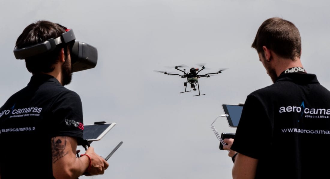
• El AeroHyb es la mejor alternativa al helicóptero en trabajos audiovisuales, ya que puede equiparse con cualquier cámara y mantenerse en el aire hasta 7 horas
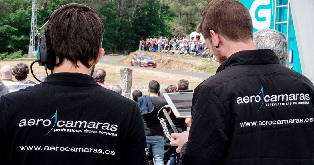
Aerocamaras sigue rompiendo barreras al protagonizar el primer directo desde dron volando cerca de 3 horas de forma ininterrumpida. Participamos en la grabación y transmisión del Rally de Ourense, prueba incluida en el campeonato de España, utilizando el AeroHyb, el multirrotor con mayor autonomía de vuelo del mundo, equipado con una cámara Zenmuse Z30. Gracias a que esta aeronave combina electricidad y gasolina para funcionar, prestamos cobertura aérea en la carrera durante cerca de 3 horas sin necesidad de detener el vuelo del dron para cambiar baterías. Este es un gran avance en comparación con las aeronaves de la competencia, que pueden mantenerse en el aire un máximo de 30 minutos hasta que tienen que volver a tierra para cambiar las baterías. Para la realización de este trabajo, desde Aerocamaras también aportamos un Inspire 2.
Una de las grandes ventajas del AeroHyb es su versatilidad y capacidad para transportar y utilizar cualquier cámara, convirtiéndolo así en la herramienta perfecta para realizar trabajos audiovisuales. Por ello, este dron es una gran alternativa al helicóptero. Tiene la capacidad de filmar tomas y grabar eventos de larga duración con la ventaja de ser mucho más funcional y económico. Competiciones como el Tour de Francia, Fórmula 1, Moto GP, regatas… podrían ser cubiertas con facilidad gracias al AeroHyb. El dron desarrollado por Aerocamaras es capaz de hacer un seguimiento completo y de la máxima calidad manteniéndose en el aire durante toda la duración de eventos de máximo nivel.
Transporte de cargas de hasta 5 kilos
El AeroHyb ha sido testado por nuestros expertos durante 15 meses para asegurar que, a día de hoy, se pueden garantizar sus prestaciones y confirmar que es la mejor opción que existe en el mercado profesional de drones. Uno de los puntos fuertes de este multirrotor es su capacidad para transportar cargas de hasta 5 kilos de peso. Esto asegura la posibilidad de utilizar las mejores cámaras para que las grabaciones y las retransmisiones tengan una calidad inigualable. Por supuesto, esta característica también convierte al AeroHyb en una aeronave perfecta para realizar trabajos como: inspecciones técnicas, apoyo en situaciones de emergencias y seguridad, agricultura, ganadería, topografía, arqueología… Y, por si esto fuera poco, el AeroHyb tiene un rango operativo de 100 kilómetros y puede plegarse fácilmente para ser transportado en cualquier vehículo.
La versatilidad del AeroHyb hace posible que se le incorpore la tecnología LIDAR, la cual permite obtener las imágenes necesarias para realizar con gran precisión trabajos relacionados con:
• Inspección de redes eléctricas.
• Arqueología.
• Agricultura forestal.
• Tecnología.
• Líneas ferroviarias.
• Topografía.
• Monitorización de infraestructuras.
• Supervisión urbana del medioambiente.
La tecnología LIDAR es un sistema láser que permite medir la distancia entre el punto de emisión de ese láser hasta un objeto o superficie. El tiempo que tarda ese láser en llegar a su objetivo y volver del mismo es lo que nos dice la distancia entre los dos puntos. El resultado es que se puede obtener un mapa en 3D de alta resolución para conocer el terreno en cuestión.
The Spanish company Aerocamaras continues to break barriers to star in the first live from drone flying about 3 hours uninterrupted. Aerocamaras participated in the recording and transmission of the Ourense Rally, a test included in the Spanish championship, using the AeroHyb, the multirotor with the largest flight range in the world, equipped with a Zenmuse Z30 camera. Thanks to the fact that this aircraft combines electricity and gasoline to work, Aerocamaras provided aerial coverage in the race for nearly 3 hours without the need to stop the drone’s flight to change batteries. This is a breakthrough compared to competing aircraft, which can stay in the air for up to 30 minutes until they have to return to the ground to change the batteries. For the accomplishment of this work, Aerocamaras also followed the test by offering aerial plans with an Inspire 2.
One of the great advantages of the AeroHyb is its versatility and ability to transport and use any camera, making it the perfect tool for audiovisual work. Therefore, this drone is a great alternative to the helicopter. It has the ability to shoot and record long duration events with the advantage of being much more functional and economical. Competitions such as the Tour de France, Formula 1, Moto GP, regattas… could be easily covered thanks to the AeroHyb. The drone developed by Aerocamaras is able to do a complete follow-up and of the maximum quality staying in the air during all the duration of events of maximum level.
Transport of loads up to 5 kilos
The AeroHyb has been tested by Aerocamaras experts for 15 months to ensure that today its performance can be guaranteed and to confirm that it is the best option in the professional drone market. One of the strengths of this multirotor is its ability to carry loads of up to 5 kilos in weight. This ensures the possibility of using the best cameras so that recordings and broadcasts have an unrivalled quality. Of course, this feature also makes the AeroHyb a perfect aircraft for work such as: technical inspections, emergency and security support, agriculture, livestock, topography, archaeology… And if that’s not enough, the AeroHyb has an operating range of 100 kilometers and can be easily folded to be transported in any vehicle.
The versatility of the AeroHyb makes it possible to incorporate LIDAR technology, which allows you to obtain the images needed to perform with great precision work related to:
– Inspection of electrical networks.
– Archaeology.
– Forest agriculture.
– Technology.
– Railway lines.
– Topography.
– Infrastructure monitoring.
– Urban environmental monitoring.
LIDAR technology is a laser system that measures the distance between the point of emission of this laser and an object or surface. The time it takes for this laser to reach its target and return from it is what tells us the distance between the two points. The result is that a high resolution 3D map can be obtained to know the terrain in question.


